Okay, That Stream in Downtown Seoul Has Bridge Names? Let's Get Into It
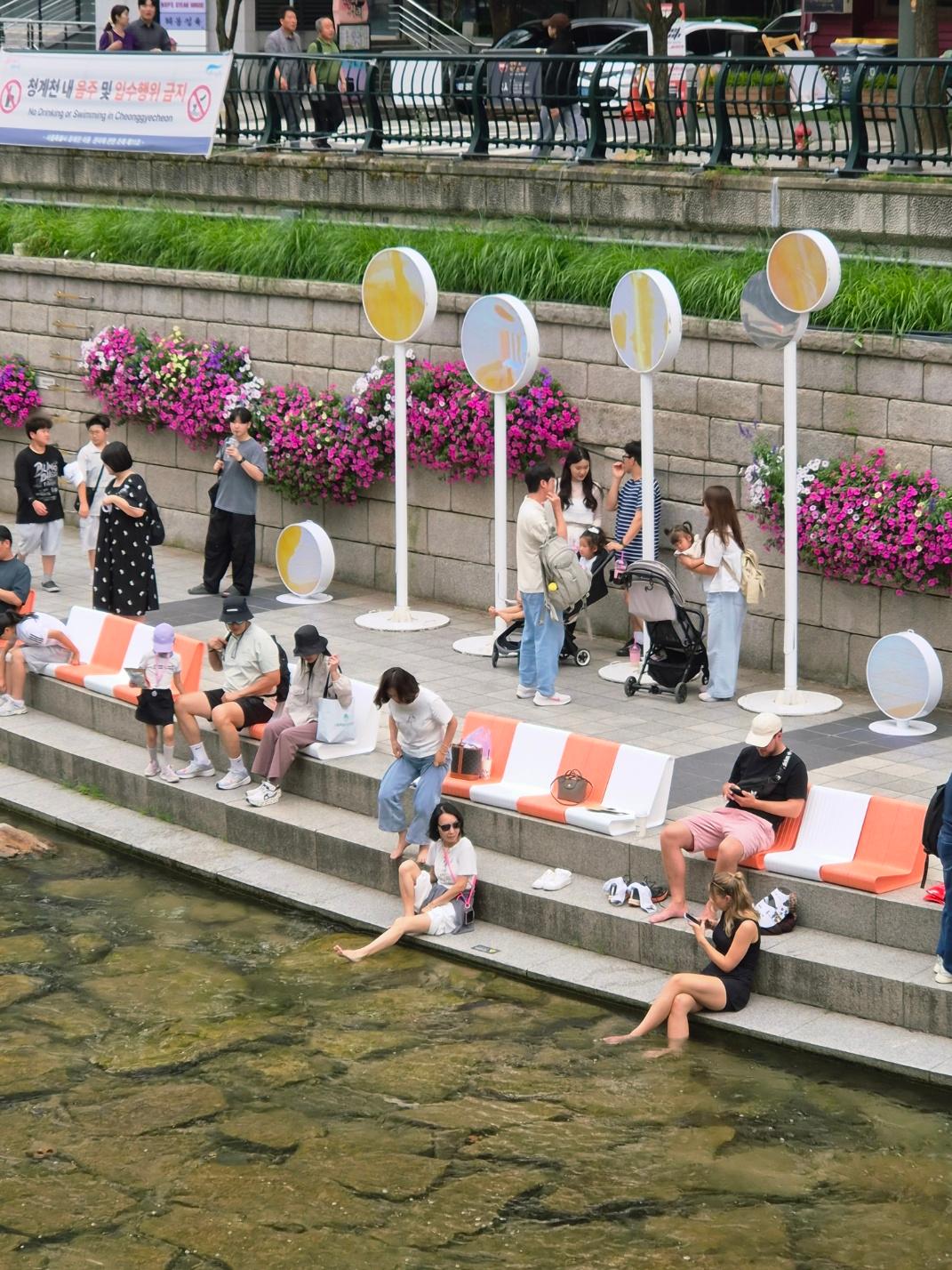
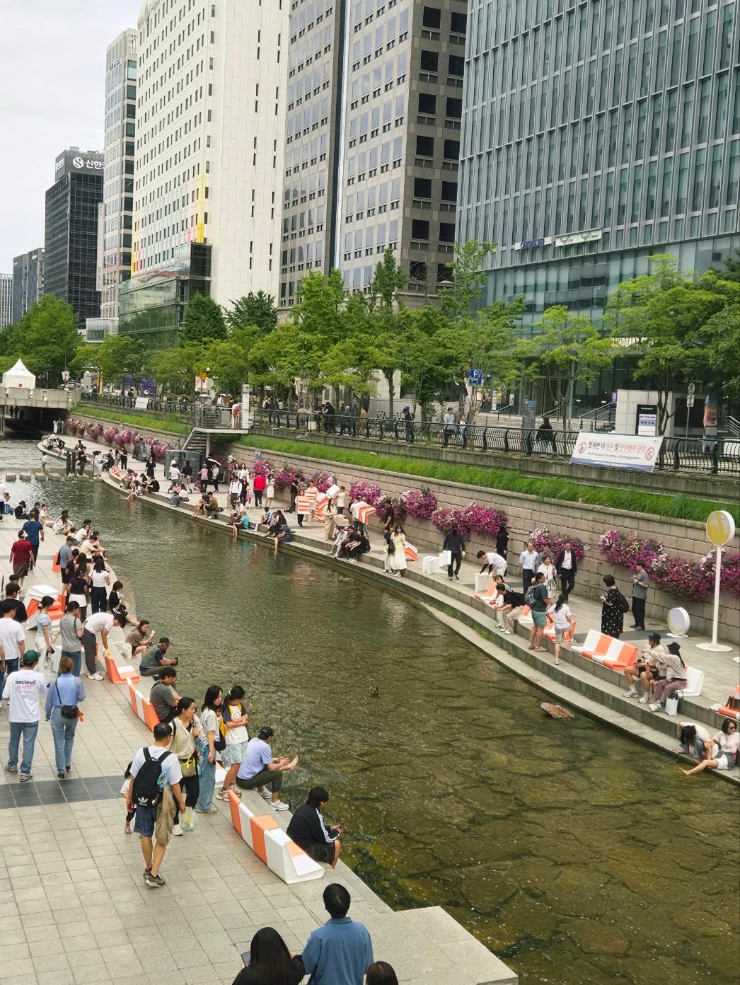
So picture this: you're walking through downtown Seoul, surrounded by glass skyscrapers, and suddenly there's a stream running right through the middle of it — with people sitting on the steps, feet in the water, like it's the most normal thing in the world. That's Cheonggyecheon. And the bridges crossing it? They all have names. Real talk, locals actually use them as landmarks — "meet me at Gwanggyo" is a totally normal sentence in Seoul.
Wait, What Even Is Cheonggyecheon?
Cheonggyecheon (청계천, say it: chung-gyeh-chun) is a stream that runs for about 11 km through the heart of Seoul, with roughly 5.8 km of it restored and walkable in the downtown core. It's not some natural hidden creek — it's a stream with a seriously complicated history.
Here's the timeline, no fluff: in 1958, the city covered the stream with concrete to deal with sanitation and traffic problems, and by 1971 there was an elevated highway running right on top of it. For decades, most of central Seoul had no idea a stream even existed under their feet.
Then in 2003, Seoul tore the highway down and spent about 386 billion won restoring the stream, finishing in 2005. It's one of the most cited urban restoration projects in the world — Seoul's own project documentation says it picked up an award at the Venice Biennale for public administration, and outlets like Reuters and the BBC covered the reopening at the time.
Okay But Here's the Bridge Thing
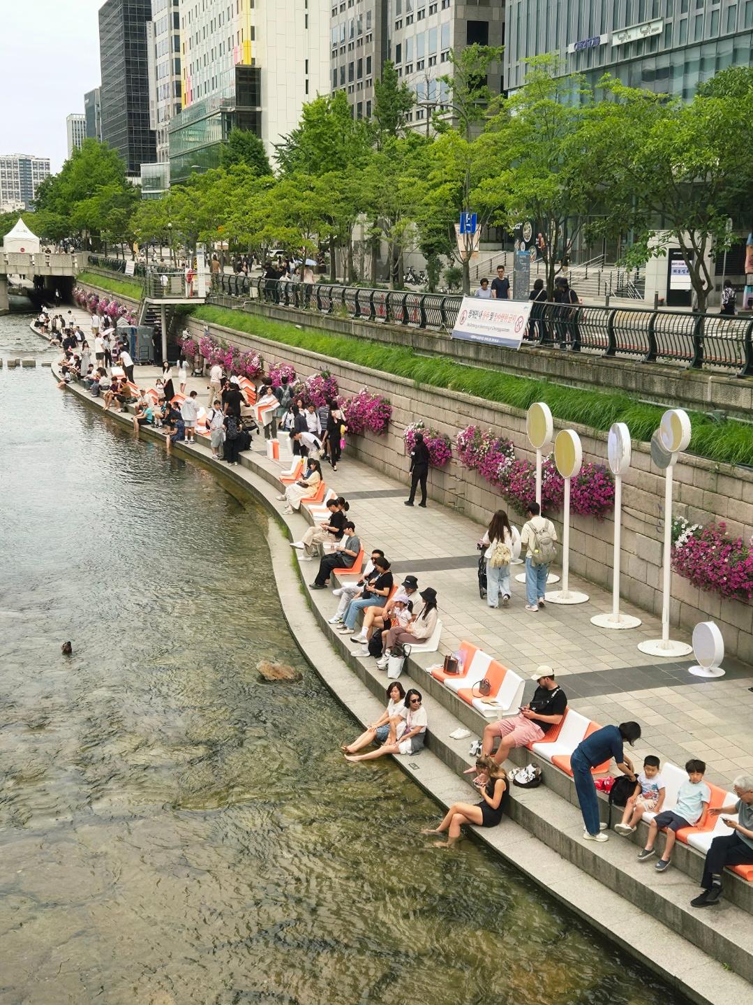
This is the part that makes Cheonggyecheon different from "just a nice river walk." There are 22 pedestrian bridges along the restored stretch, and almost every single one has a name with actual history behind it. Locals genuinely use bridge names to give directions — it's giving "meet me at the clock tower" energy, except it's a literal bridge from the Joseon dynasty.
Based on where these photos were taken — right behind Jongno 1-ga — that's Gwanggyo (광교), and it's lowkey one of the most historically loaded spots on the entire stream.
The backstory: Gwanggyo's original name was Daegwangtonggyo, built all the way back in 1410 under King Taejong, and it sat on the main route connecting the royal government offices to Namdaemun Gate. It was THE bridge of Joseon-era Seoul — basically Main Street. It got buried under tram tracks in 1899, then fully disappeared when the stream was paved over in 1958. When Seoul restored Cheonggyecheon in the 2000s, they rebuilt the historic bridge (now called Gwangtonggyo) about 150 meters upstream from its original spot to avoid disrupting traffic, and built a modern bridge called Gwanggyo at the original location so cars could still cross.
Where Seoul's most important bridge has existed in some form for over 600 years. Iconic? Yes. We're not okay (in the best way).
The Naming Pattern Is Honestly Kind of Genius
Once you know Gwanggyo, the rest of the bridges start making sense. Korean bridge names from this era usually come from one of two things: what was nearby, or who used to live there.
A few examples, fact-checked against Seoul's official Cheonggyecheon archives:
- Mojeongyo — named for the mojeon, old fruit shops that used to sit at this corner
- Supyogyo — originally called Majeongyo because livestock traders worked nearby, then renamed after a water-level measuring stone (supyo) was installed in 1441 to track rainfall
- Beodeuldari ("Willow Bridge") — named for the willow trees that lined the stream nearby; it's also where a statue honoring labor activist Jeon Tae-il stands today
Real talk — there used to be barely any public meeting spots in old Seoul, so bridges WERE the meeting spots. People hung out there, made plans there, told stories about them. That's why they all got names instead of just numbers.
How to Actually Find This Stuff
If you want to go full bridge-spotting tourist (no shame, it's genuinely fun), here's the move:
- Start at Cheonggye Plaza near Gwanghwamun — that's the western starting point of the restored stream
- Walk east and you'll hit Mojeongyo, then Gwangtonggyo (the historic one) and Gwanggyo (the modern traffic bridge) in quick succession
- Most bridges have small plaques with their name and history in Korean and English — look down near the stairs as you approach
- Wearing sandals or shoes you don't mind getting wet is honestly the move, because dipping your feet in is extremely normal here, foreigners included
And yes, the water is intentionally maintained — Seoul pumps in water from the Han River and treated groundwater to keep a consistent flow, since Cheonggyecheon is naturally a dry-most-of-the-year stream. So it's not "wild river water," but it's clean enough that wading is a normal, expected thing to do on a hot day.
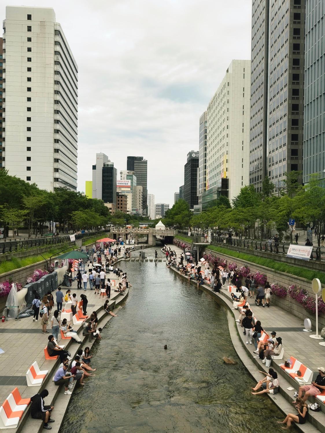
Wide aerial shot of Cheonggyecheon stream curving away into the distance between rows of tall Seoul buildings, with people seated on benches along both banks under an overcast sky
Why This Hits Different Than Just "Pretty City Stream"
Here's the thing — a LOT of cities have a river walk. Not a lot of cities have a river walk where every single crossing has 600 years of layered history, got buried by a highway, then got dug back up on purpose. Cheonggyecheon is basically a timeline you can walk through: Joseon-dynasty stone bridges, Japanese colonial-era tram infrastructure, 1960s–70s industrial Seoul, and then 2005 "let's bring the water back" Seoul — all stacked in the same 5.8 km stretch.
Next time you're cooling your feet off at Gwanggyo, you're not just at a nice spot in the city. You're standing where Seoul's most important road has crossed water for over six centuries.
Have you walked Cheonggyecheon before, or did you have no idea the bridges had names until right now? Tell us in the comments — we wanna know which bridge you'd visit first!
#CheonggyecheonStream #Gwanggyo #SeoulHistory #KoreanCulture #VisitSeoul #SeoulVibes #JoseonDynasty #KoreaTravel #SeoulTravel #UrbanRestoration #SeoulLandmarks #KoreaHistory #DowntownSeoul #JongroDistrict #KGallery #ExploreKorea #SeoulWalkingTour #KoreanHeritage #SeoulCitySights #AsianCulture
Recommended Products

JMsolution
JMsolution Glow Luminous Flower Sun Spray Rose (SPF 50+ PA++++) 180ml
$13.90
Shop Now
SKIN1004
SKIN1004 Hyalu-Cica Water-Fit Sun Serum UV SPF50+ – Korean Sunscreen
$16.15
Shop Now
hyggee
HYGGEE All in One Mist - Hydrating & Soothing Face Essence Spray for All Skin Types - Probiotics & Birch Sap Extract - Oil Control Gas Free Mist - Skin Irritation Free, 3.38 fl.oz.
$23.00
Shop Now